Mannagement of Urban Space
Urban development and planning is a continuous process involving administrators, investors, developers, and of course the local inhabitants.
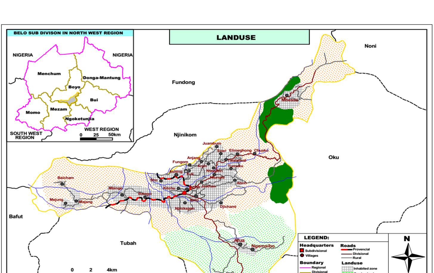
In managing the Belo urban space, the following elements come into play, the built-up area and Settlement, Forest, Agriculture (Farming and grazing), Grassland, Water bodies and other features. The urban space also forms the core of commercial activities in the Council area. Famous infrastructures include the main market, Motor Park, churches and institutions of learning. These infrastructures are widespread in the urban space with no specific plan on land use. These structures are interspersed with commercial and non-formal activities without any proper planning. Interestingly, there office of the council town planner is headed by a staff who has no background knowledge in town planning. He was redeployed from another service.
4.2.1.5.2: Land Use Plan and Management of the Belo Council Space
Spatial distribution of land use/ land cover information and its changes in the Belo Council area is desirable for development planning, management and monitoring of programs at local, regional and national level. This information does not only provide a better understanding of land utilisation aspects but also play a vital role in the formulation of policies and programs required for developmental planning. For ensuring sustainable development, it is necessary to monitor on-going changes in land use/ land cover pattern for over a period of time.
The land use/ land cover for the Belo Council area are made up of 346,068 km2. This land is characteristically hilly grass field with difficult topography and patches of both natural and man-made forests. Waste land also makes up and important percentage of the total land. Water bodies are very remarkable, with some taking their rise from the hill tops within the Council area.
There are 115 educational establishments, 15 health facilities with a ‘referral’ hospital, 10 administrative units. These structures are interspersed with commercial and informal activities with no proper planning. The council area has a main periodic market at Belo. The market has part permanent structures with over 90% of the stalls made up of temporal materials. Most of the commercial activities are centred in the central of the urban space.
The landuse of the Council area is shown on the table below:
Table 39: Land use/ Land cover in the Belo Council area
| S/N | Class | Sub Class |
| 1 | Built up Land | Town Settlement |
| 2 | Village settlement | |
| 3 | Agricultural land | Crop land |
| 4 | Fallow land | |
| 5 | Plantation | |
| 6 | Forest | Conserved forest |
| 7 | Community forest | |
| 8 | Savannah | |
| 9 | Grass Land | Woodland savanna |
| 10 | Open land | |
| 11 | Others | Quarries |
| 12 | Degraded rocks – sand | |
| 13 | Swampy bush land | |
| 14 | Marshy/ Swampy Land | |
| 15 | Water bodies | Rivers/ Streams |