
3.2 Biophysical milieu
3.2.1. Relief description
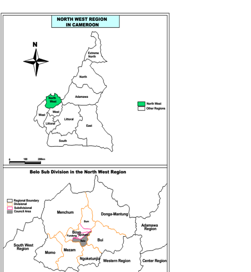
The Belo council area is found in the mountainous stretch of the western highlands agro-ecological zone of Cameroon. About 80 % of the land within the municipality is situated above 1900 meters in altitude and the topography is characterized by mountains, escarpments, valleys and plateau. The slopes range from 40-70 % with undulating hills and deep valleys. There are two broad valleys separated from each other by mountain ridges like the Aweh and Tzchigon ridges which all join to form part of the Ijim-Kilum mountain range which measures 3000m above sea level. Heavy rainfall is often recorded in August and September. The undulating nature of the area coupled with heavy rains often result to numerous landslides.
Lowland swampy areas are Mejung and Baicham. Rolling gentle hills include: Mbingo and The Ndawara plateau (2100 m asl) while the steep jagged hills within the municipality include: the Baingo escarpment. The Mbi crater falls within the protected area in the sub division.
3.2.2 Hydraulic description
There are many rivers and streams found in the area. Most of these rivers take their rise from the Ijim-Kilum Mountain and form headstreams of the Menchum River. The streams/rivers take different names along their courses and the main river which flows across Belo is river Mughom. Other major streams include the Mufua, Chuangchuang and Meng in Mejang. Also found in the sub division are prominent springs and waterfalls which flow down the mountain or hill slopes especially during the rainy season. However, some of these streams and waterfalls are seasonal. Also, present in the sub division is the Mbi Crater Lake and waterfalls such as; The Ngewi, Melung, Ntemnyam and Mughomi falls.
3.2.3 Soil description
Although the soils are dominantly volcanic, Belo sub division has two main soil types: ferrallitic and lateritic soils. About 75 % of the soils are derivatives of either basalt or granite while some are also derived from alluvial deposits. In areas like Baingo, Belo and Anyajua, parent rocks like basalt and granite are commonly found. The acidic content of the soil (pH) often ranges from 5.5-7.0. Generally, the ferralitic soils are on steep sloping grounds and largely account for frequent soil erosion.
3.2.4 Forest (flora, fauna)
Although generally described as humid tropical or humid savannah with grass and shrubs, the vegetation of Belo sub division is varied and the major types include: savannah woodlands, forest woodlands, semi-deciduous forests and re-growth savannah. The humid savannah woodlands which are overgrazed are found between isolated clumps of gallery forests along river courses in places like Djichami, Baicham and Mejung; the montaine forests are found on the Ijim mountain ridge, Ndawara and parts of the Mbi Crater while the semi-deciduous forests are found around Mejung and `Mejang. Re-growth savannah grasses are found in places where the population density is low. There exist several trees I the forest that are of human value. The table below show the trees fro I the Ijim forest.